Family Outdoor Activities, Beijing's Six Famous Camping Spots
1, White River Camping - Super Leisure Route, Suitable for All Ages.
White River can enter from Huairou, can also enter from Miyun. Most routes enter from Miyun Qingshiling.
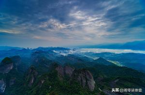
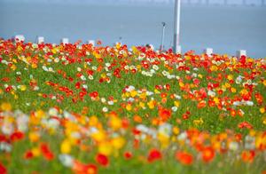
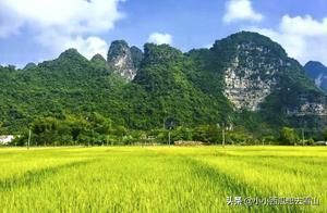
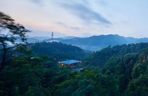
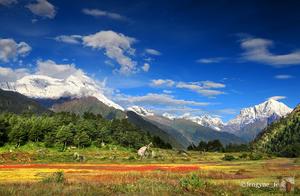
White River Canyon is a gorge located in the northeastern part of the old county of Yunxian, Yanqing District, and flows from the White River Reservoir to the Miyun Reservoir. It is a relatively well-preserved primitive canyon, described as a 'hundred-mile picture gallery moving image'. It is the filming base for 'Bulletproof Boy'. The canyon road is steep, the villages are relatively sparse, and the strange scenery of nature is quite shocking. Please note that White River Canyon is a tributary of the Yongding River, which flows through the White River Reservoir and then into the Miyun Reservoir. The riverbanks are beautiful and suitable for camping and picnics.
Travel Tips:
Self-driving car:Take the Jingcheng Expressway, take Jingjia Road (National Highway 101), follow the navigation prompt.
Recommended destination: 'Qingshiling' or 'Quhutang'.
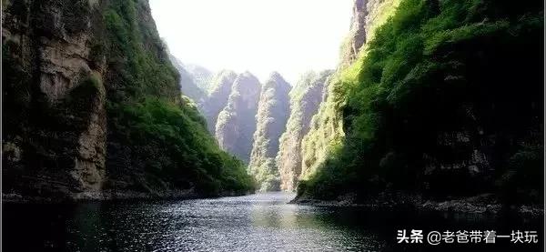
2, Zhuxiu Canyon - Can View Beijing Wall Road.
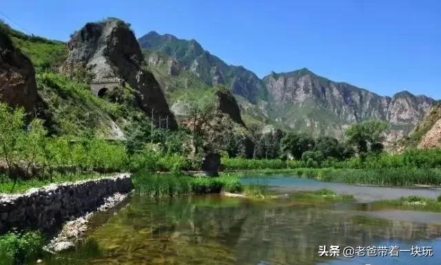
Located in the Zhuxiu Canyon in Hebei Province, north from the Great Dam of Guanting Reservoir, south to the Yongding River in Menchuigou District, Fengtang, the canyon has towering mountains on both sides and a bottom of Yongding River.
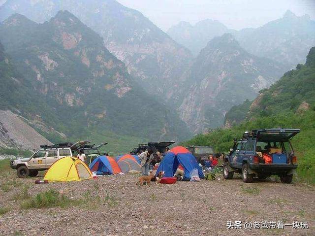
Zhuxiu Canyon was a major north-bound channel for Beijing, once prosperous and now very quiet. You can see wide riverbanks and clear water, which is very suitable for camping, picnics and bonfires. Many Beijing hikers often choose to camp near Zhuxiu Village, a small forest beside the river.
Here's a reminder that the river in Zhuxiu Canyon is the upper reaches of the Yongding River, which is connected to the Guanting Reservoir. When playing on the riverside, you must pay attention to the upstream discharge. There is a kind of insect called 'horse flies' in the canyon, which bites very painfully. If you go in summer, you must bring insect repellent.
Zhuxiu Canyon is one of the classic beginner hiking routes around Beijing. If you don't want to hike, driving to Zhuxiu Village to camp is also a good choice. Yongcheng City is about 15km from Zhuxiu, which is the Yongcheng City Wall.
Travel Tips:Self-driving car
: Take Menchuigou National Highway 109, about 80km from the exit of Beijing to Chaotang, you can see the sign 'Yongcheng City Wall' when you are close, turn right about 14km to reach Yongcheng City Wall.
3, Beijing's Highest Peak – DonglingshanRecommendation reasons:
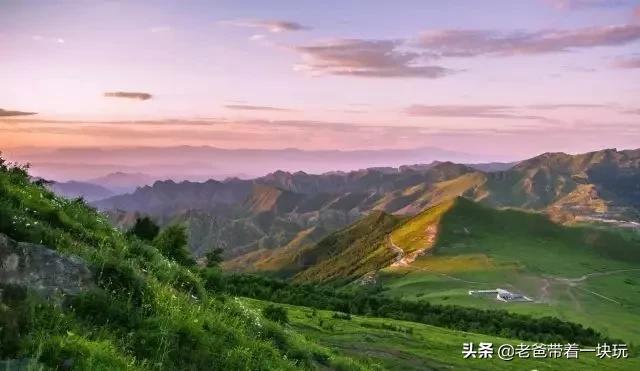
You can camp on Donglingshan, Beijing's highest peak (main peak altitude 2303 meters). In summer, the grassland on the summit will make you think you are in an endless grassland. There are also many maple trees on the road to Linhshan, and it will be beautiful in autumn.
At the summit, there is a large lawn that can be camped on. Looking west, the small Five-Temple Mountain is. When coming back, you can take a downhill ride across Linhshan, plus camping, it's a fun experience. In the cold weather, it's not recommended to go. The wind is strong, it's recommended to camp in the forest at the foot of the mountain.
Self-driving car: Take Menchuigou 109 National Highway, pass Chaotang, you can see the sign for 'Apple Garden' about 100km from Beijing, after arriving at Apple Garden, drive about 100km.Tips: The ski field of the Winter Olympics has been designated as Donglingshan, so it's best to go as early as possible, the situation may change at any time, and it may be closed soon.
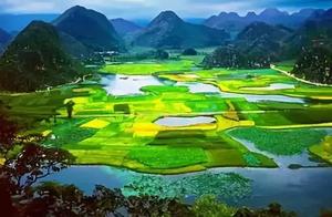
4, Yunmeng Scenic Area – Original and Wild Beauty.Recommendation reasons:Yunmeng Canyon has original and beautiful natural scenery. It is mainly characterized by danger, beauty and wonder. It is very suitable for outdoor fitness and camping expansion activities.Experience:
You can set up a tent in the depths of Yunmeng Canyon, especially in the area of the He River, barbecue, etc. It is necessary to inquire in advance about the situation, and it is prohibited to burn during the fire period.Tips: The night temperature is low, you need to bring thick clothes. The car route: Jingcheng Expressway, Miyun direction, follow Miyun urban area, down the expressway to the north for about 10-15km, after reaching the road, about 1-2km to the bad road.
5, Famous Mountain Peak – Haita Mountain
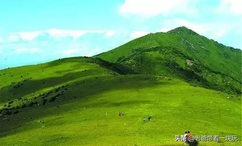
1, Haita Village Route:This is the nearest route to Haita Mountain, but it's very inconvenient to take transportation back and forth, so it's recommended to drive or rent a car. You need to drive up the mountain. The road is good, the distance is short, and the climbing is not high.
2, Beer Creek Route:There are two large climbing points at the head and tail of the road, the middle section is relatively gentle, suitable for people with good physical strength.
3, West Dazhuang Ko Route:It's steeper, but the distance is relatively short. It's recommended to stay in West Dazhuang Ko the day before, and start climbing early in the morning.4, Songshan Route:Very steep, very dangerous, it requires a certain level of mountaineering experience, strong physique and willpower. It is suitable for people with certain mountaineering experience. It is not recommended for beginners to go.
5, Yudawa Mountain Route:You can reach the Yudawa Scenic Area by walking deep into the mountains, and you can reach the ancient town directly. This route I haven't experienced.
6, Yan's Ridge Route:
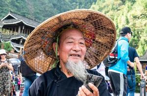
The route is not very steep, but you need to climb over several small hills (I said there are 15 or 20), if you don't have a good physical strength, you can use the lyrics of 'I keep hoping, keep disappointed, it's hard for myself to taste, and never see the top, haha'
Self-driving car route: Beijing City – Yanqing County City – West Dazhuang Ko – Haita Village – Start climbing from where to choose (currently being built for the Winter Olympics, the situation is unclear)Backup route: Go to Haier down the expressway, navigate to reach Haier.
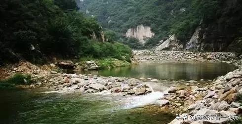
Tips: The Winter Olympics ski field has been designated as Haita Mountain, so it's best to go as early as possible, the situation may change at any time, and it may be closed soon.6, He River – The Holy Land of Hikers, the Paradise of Decay.
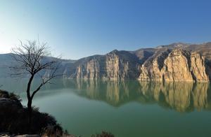
He River is known to hikers in Beijing, everyone knows it and everyone knows it.It is located on the east side of Haita Mountain in Yanqing County, West Dazhuang Ko, in the canyon of He River, the original and unspoiled natural scenery. Some people also call it Ancient City River. In fact, He River is a tributary of the Yongding River, originating from the north of Haita Mountain and flowing into the Yongding River.
Travel Guide:
Take the 919 express bus from Deshengmen, and get off at the ending point of Yanqing Auto Station. There are many faces on the station, about 30 yuan to the Longju Zhuang, then take a driver in Yanqing to the hotel.
Entering the mountain guide:
When entering the entrance of the canyon, you can see a dam or gate, written 'Longju Canyon', pass through the fence, drive along the road, reach the peak (the time to reach the peak is about 40 minutes).
After reaching the peak, follow the most obvious small road, and you will reach He River!
After descending, walk along the river on the right, about 2 hours will reach He River (Longjing Reservoir tail lake).
Warm tips:
You can camp at the tail lake, it is very spacious, and the fish in He River is very fat, you can bring a decaying fishing gear.
Warm tips:This article comes from the internet, and some netizens have sorted it out for hiking families. If there is any infringement, I will delete it. These places are the favorite camping places for parents and children hiking, and may have some changes. Please pay attention when traveling.