New Congue Highway: As Heavenly as Paradise, as Hellish as the Abyss – Are You Brave Enough to Challenge It?
From Lhasa to New Congue City, the total length of the New Tibetan Highway is 2841 kilometers, and the average altitude is considered the world’s leading road. From Liujinhe to Ye, it passes hundreds of kilometers of uninhabited areas, climbs over 7 large slopes, and the majestic Kunlun Mountains make people feel small. The desolate and vast uninhabited areas make people feel shocked. Ye’s zero kilometer, the starting point of the New Tibetan Line, came to a sudden halt.
What can you see on the New Tibetan Line?
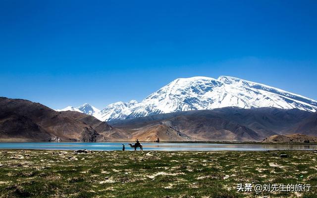
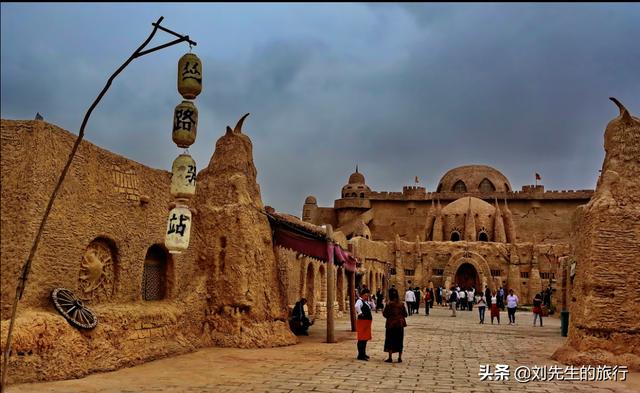
You can see the Kashgar Bazaar (Central Asia International Trade Market), the Gar Old Town, the Apaqhoja Tomb (Xiangfei Tomb), Eltihuar, the Zepu Golden Hornin National Forest Park, the Pamir Plateau, Muztag Ice Peak, the Karakul Lake, the Redgila Pass, Ye zero kilometer, Kudo Slopes, Maizha Slopes, Jiagogou Peak, Heka Slopes, thirty-mile camp, red willow beach, dead man’s ditch, spring water ditch, Aksei Lake, sweet water sea, border mountain slopes, Kunlun Mountains.
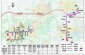
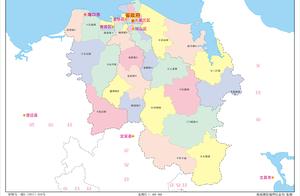
New Tibetan Highway map (horizontal viewing)

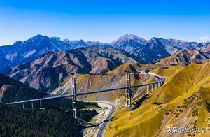
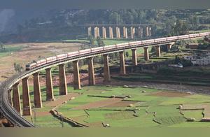
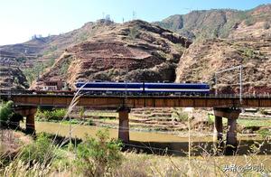
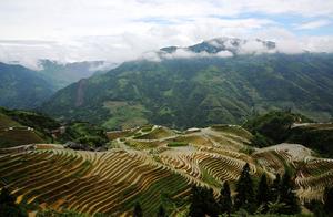
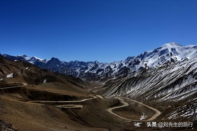
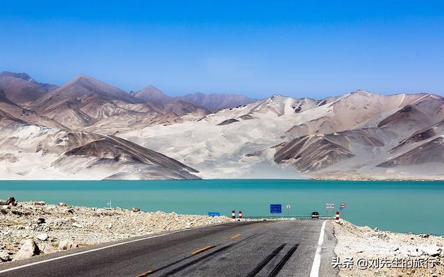
The magnificent New Tibetan Highway – clouds enter the sky, cars enter the clouds
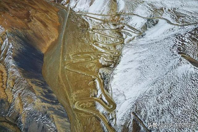
The New Tibetan Highway is also known as National Highway G219. The complete New Tibetan Line starts from Ye’s ‘0 kilometer’ monument and extends south through Tibet to Liujinhe, then extends east to Lazi County until it connects with National Highway 318. This national highway is 2140 kilometers long. If you include Lazi to Lhasa’s 318 National Highway, it exceeds 2550 kilometers, making it the longest entry route into Tibet. ‘The New Tibetan Line is more difficult than the Sichuan Road. The Kudo Slopes are dangerous, as if entering the netherworld; the Maizha Slopes are sharp, rising five thousand three; the Heka Slopes are spiral, ninety-nine bays; the border mountain slopes are curved, you can touch the sky...’ This rhyme vividly describes the difficulty of the New Tibetan Line. Especially from Ye to Liujinhe, 1455 kilometers, is not only the world’s highest average altitude road, but also the most significant height difference road. It traverses the world-famous Kunlun Mountains, the Kunlun Mountains, the Gandesi Mountains, and the Himalayas, climbs 16 ice slopes, and traverses 44 ice rivers. It needs to pass through the border mountain slopes and the dead man’s ditch. The altitude ranges from over 900 meters in Xinjiang, climbed 5248 meters to the border mountain slopes, and the Kudo Slopes.
After the New Tibetan Highway reaches Liujinhe, it extends the main line to the Ali South Line and the Ali North Line and the Ali Middle Line.
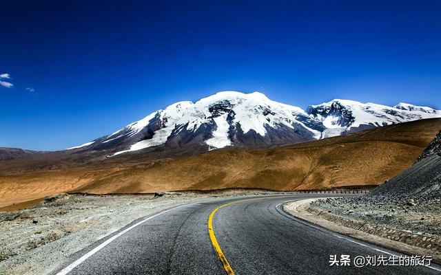
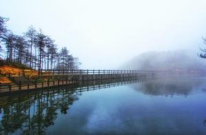
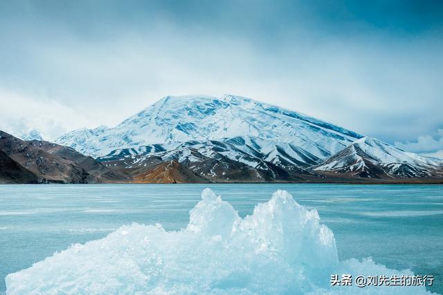
The New Tibetan Highway is a vital transport artery in western Tibet, with 130 kilometers of road sections above 5000 meters, which is the most difficult entry route into Tibet. Although the scenery is not as vibrant as the Sichuan Road, it also has magnificent beauty. Walk where others cannot go, and see what others have not seen. The continuous snow mountains, dense lakes, and the ubiquitous wild animals make it a paradise for adventurers.
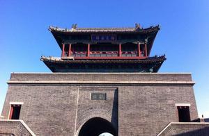
The beginning of the Xinjiang dream – Kashgar
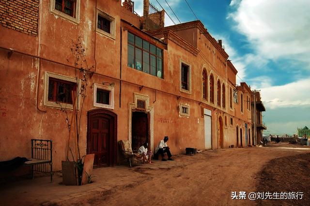
Kashgar is a shortened form of Kashgar, meaning ‘a place like jade’. It is the westernmost city in China, facing the Tarim Basin to the east and the Pamir Plateau to the west. As early as more than 2100 years ago, it was the southern and northern ends of the Silk Road in the west, China’s key transport hub and gateway for economic and cultural exchanges with the West.
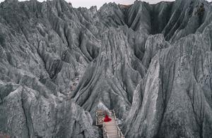
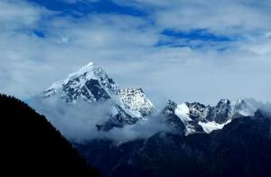
The world’s most dangerous mountain peak – Jiagogou Peak
K2 Peak in the movie. That is the main peak of the Kunlun Mountains, with an altitude of 8611 meters, the second highest peak in the world. The peak’s crown is in the shape of a golden pyramid, with icy walls standing upright, and the mountain range is steep and treacherous. There are snow slide channels carved into the steep slopes, and the average slope exceeds 45 degrees on the northern side. From the northern big camp to the peak, the vertical difference reaches 4700 meters, which is the largest vertical difference of 8000 meters above sea level peaks in the world.
Recommended travel itinerary for the New Tibetan Highway
D1: Lhasa – Quyuwu – Gangbala Mountain – Yangzhuo Yongcuo – Kajo La Glacier – Erimu – Baiju Temple – Daying – (Shocking Tour)
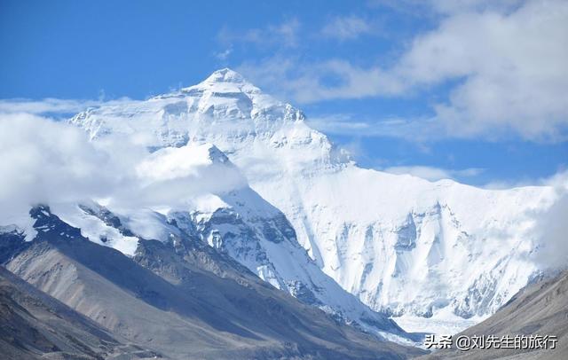
D2: Daying – Zhasharlem Temple – Lazi – Jiaqiu La Mountain – Dingri – Kuuluya Slope (Watch Makalu Peak, Luozi Peak, Mount Everest, Thaooyu Peak) – Rongbu Temple (Surprise Tour)
D3: Rongbu Temple – Mount Everest Base Camp – Old Dingri – Shishabang Peak – Peki Tea Lake – Sagga (Soul Heaven)
D4: Sagga – Paya – God Mountain: Gongbei – Holy Lake: Mapungunuo – Namkana Peak – Tarchen (Wash Away Your Soul)
D5: Tarchen – Ghost Lake: Laonuo Lake – Qixu Temple – Pulan – International Trade Market (Mysterious Legend)
D6: Pulan – Balping Station – Zada County – Tolin Temple – Zada Stone Forest – Duguo Dynasty – Zabu Leng Village (Eternal Mystery)
D7: Zada – Namga – Liujinhe (One Line to Heaven)
D8: Gar (Liujinhe) – Bangong Lake – Ritui Rock Carvings – Doma (Oyster Bay)
D9: Doma – Red Earth Slopes – Border Mountain Slopes – Tiete Slopes – Kucha Slopes – Kunlun Mountains – Ye (Dreamy Temptation)
D10: Ye – Xiangfei Tomb (Xiangfei Tomb) – Eltihuar – Kashgar (Ancient Charm)
D11: Kashgar Return
For more interesting travel information, please follow the headline – Mr. Liu’s Travel!
D12