Liaoyang City's Location is Advantageous
Liaoyang City is located in the southern hinterland of Liaoning Province, a developed urban agglomeration centered around Shenyang City. It is connected to the Shenhai High Speed Road and the Changliao Railway as its main traffic arteries, extending north for 60 kilometers. It is adjacent to the national machine manufacturing center, Shenyang City, and connects to the largest oilfield in China, Daqing Oilfield, through the oil and railway pipelines via Changchun City and Harbin City. It is connected to the Liaoxi Railway and Liaoxi Highway as transportation links, extending east for 79 kilometers to the neighboring Benxi City, known as the ‘City of Coal and Iron’, going south for 26 kilometers to connect with the largest steel industrial base,(Anshan), and south for 125 kilometers to reach the port city of Yingkou, adjacent to the largest sea port of China and the coastal opening city of Dalian, which is 332 kilometers away. It is connected to the Liaoyang Oilfield hinterland via the Panjin City railway and highway. It can also be connected to the whole country and the world through Shenyang Airport and Dalian Port.
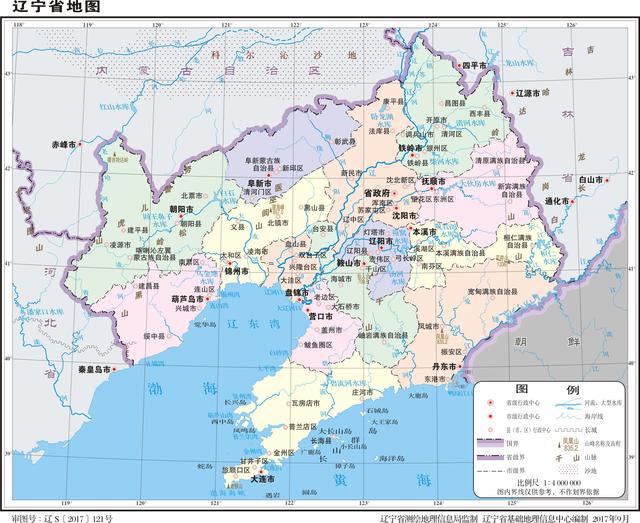
Liaoning Province Map
Liaoyang City's geographic coordinates are 122°35′E – 123°40′E and 40°42′N – 41°36′N.
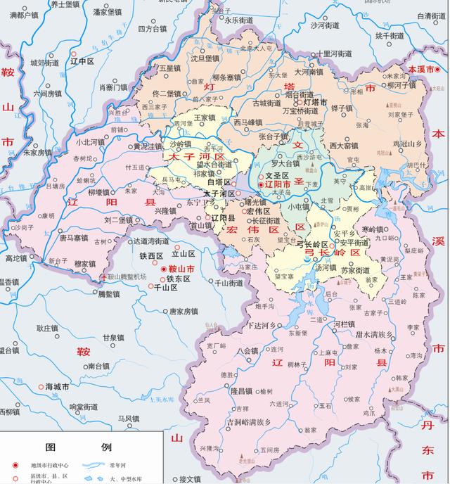
Liaoyang City Administrative District Map
The total area of Liaoyang City is 4743 square kilometers, with its extreme length from west to east being 92.3 kilometers and from south to north being 100.3 kilometers.
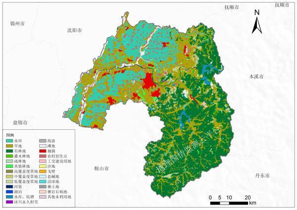
Liaoyang City Land Use Map
Liaoyang City's natural location is superior, with its southeastern area located at the western foothills of the Qian Shan Mountains, a low-mountain and hilly area; its northeastern part located at the tail of the Longgang Mountains, a hilly area; its western part located on the eastern edge of the Xia Liao River Plain, accounting for approximately half of the area. The entire area is located within the Hehun River, Taixi River and the exit of the Beixin Region from Liaoyang Ji Guanxi Wang Yu Xi Gou nearby, turning to southwest flow after passing near Xiao Be River Town, passing near Mu Jia Town Tai Dai Village to exit, flowing to Tang Ma Zhai Town San Jie Bao Village nearby, entering the boundary of Lai An County; with the Hehun River as a boundary, neighboring with Liaozhong County and Lai An County by water.